
Leave Your Message

China Top Swarm Drones for Commercial Use?

China has become a major center for commercial drone development, but “top” depends on the work required. This article examines China’s leading Swarm Drones for agriculture, infrastructure inspection, surveying, environmental monitoring, and emergency support. The focus remains practical, not promotional.

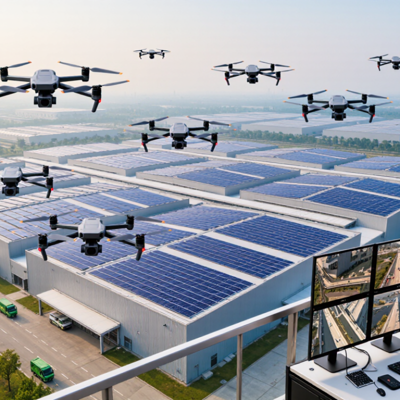
A useful commercial swarm may coordinate several aircraft, share mapped routes, and return safely when battery levels fall. Imagine ten compact drones inspecting solar panels across a large industrial site. Their cameras identify damaged surfaces, while an operator reviews alerts from a control station. That sounds efficient. Yet reliability matters more than spectacle. Weather resistance, communication stability, battery management, and software integration can determine whether a fleet performs beyond a demonstration.

This overview considers established manufacturers, available payloads, fleet-management tools, service support, and evidence from real operating environments. It also considers certification, privacy protection, airspace compliance, and trained human supervision. Product specifications can change quickly, and published flight times may reflect controlled conditions. Independent testing is still necessary. My initial assumption was that larger fleets always create better value; practical deployments often challenge that idea. A smaller, well-maintained group may deliver cleaner data and fewer operational problems. Readers should compare total ownership costs, maintenance access, cybersecurity practices, and local regulatory requirements before choosing a system. Commercial success is not guaranteed. Careful evaluation remains essential.
China Top Swarm Drones for Commercial Use?

What Defines a Commercial Swarm Drone?

China Top Swarm Drones for Commercial Use?

What Defines a Commercial Swarm Drone?

A commercial swarm drone is more than several aircraft flying together. It is a coordinated system that shares data, assigns tasks, and adjusts routes with limited human input. In a warehouse, units might scan shelves, avoid workers, and report missing inventory. Outdoors, they could inspect solar panels or map farmland. The value comes from teamwork, not fleet size.

Reliable swarms need clear operating roles. One drone may collect images while another checks a damaged area. A central platform should display battery levels, locations, task progress, and warning signals. Operators also need manual control when weather changes or sensors fail. Safety features matter, including geofencing, collision avoidance, secure communication, and controlled landing procedures. Commercial users should verify local permissions before every operation.

Field experience shows that small details can decide success. Dust can weaken sensors. Uneven battery performance can separate the group. A crowded worksite may confuse automated navigation. The definition is not perfect either. Some systems coordinate only basic routes, while others adapt continuously through shared information. Buyers should test both claims and real performance under ordinary conditions. A short demonstration may look impressive, yet maintenance costs and operator training often reveal the harder truth.
China’s Leading Commercial Swarm Drone Technologies

China’s leading commercial swarm drone technologies are moving beyond simple remote flight. They combine onboard sensing, edge computing, and coordinated route planning. Several aircraft can divide a large site into smaller tasks, while sharing location and obstacle data. The difference is coordination. In agricultural monitoring, drones can scan uneven fields and identify dry patches with consistent image coverage. For infrastructure surveys, they can inspect rooftops, bridges, and power corridors while reducing repeated manual travel.

Commercial value depends on more than flight performance. Operators need clear permissions, geofencing, encrypted communications, and reliable maintenance records. A practical control station should show battery levels, weather changes, signal strength, and each aircraft’s assigned zone. Human oversight remains essential, especially near roads, buildings, and public spaces. Automated decisions should support trained staff, not replace accountability. Data protection also matters when aerial images include homes, workers, or private facilities.

The technology is impressive, but not flawless. Strong wind can break formation. Signal interference can delay coordination. Crowded skies remain a hard problem. Field teams should test smaller groups before expanding operations, recording missed scans and false alerts. This evidence helps improve software and training. Some platforms still require frequent calibration, which can interrupt tight schedules. That inconvenience is easy to underestimate. Reliable commercial deployment will depend on transparent testing, local aviation rules, and operators who are willing to question optimistic performance claims.

China Top Swarm Drones for Commercial Use? - China’s Leading Commercial Swarm Drone Technologies

Technology Category Primary Commercial Use Typical Swarm Scale Typical Flight Endurance Payload Profile Core Swarm Capability Commercial Readiness
Multi-UAV Inspection Networks Power-line, pipeline, railway, port, bridge and industrial-site inspection Approximately 3–20 aircraft per mission About 25–60 minutes per aircraft RGB, thermal, zoom and LiDAR sensors; generally below 5 kg Coordinated route planning, sensor-data sharing, automatic task allocation and collision avoidance High for supervised and semi-autonomous operations
Coordinated Agricultural UAV Fleets Crop mapping, spot treatment, field surveying and variable-rate application Approximately 2–10 aircraft per field operation About 15–30 minutes for spray aircraft; longer for mapping aircraft Liquid tanks commonly around 10–50 litres, depending on aircraft class Parallel field coverage, geofencing, terrain following and synchronized application scheduling High in structured agricultural environments
Warehouse and Indoor AMR–Drone Swarms Inventory scanning, barcode reading, stock verification and indoor mapping Approximately 2–30 mobile units, usually within one facility About 10–25 minutes per flight, supported by automated charging or battery exchange Cameras, barcode readers, depth sensors and lightweight mapping equipment Indoor positioning, traffic coordination, shared maps and task scheduling with ground robots Medium to High in controlled facilities
Emergency Response and Search Swarms Flood response, wildfire assessment, disaster mapping, missing-person search and communications relay Approximately 5–50 aircraft in field demonstrations or coordinated missions About 20–45 minutes per aircraft, depending on payload and weather Thermal and visible-light cameras, loudspeakers, small relay modules and mapping sensors Area partitioning, adaptive search patterns, mesh communications and rapid re-tasking Medium; human supervision remains important
Urban Low-Altitude Logistics Swarms Short-distance parcel delivery, medical supplies and scheduled point-to-point transport Usually 2–10 aircraft managed through a centralized dispatch system About 20–40 minutes per aircraft, route and payload dependent Commonly around 1–10 kg for small delivery aircraft Fleet dispatch, route deconfliction, remote identification, geofencing and contingency routing Medium; dependent on approved routes and airspace access
Coordinated Light-Show Drone Systems Outdoor events, tourism promotion, festivals and public visual performances From dozens to several thousand aircraft in large programmed formations Typically 10–25 minutes per performance LED lighting modules; payload is generally limited to the display system Precise time synchronization, formation control, geofenced trajectories and automated choreography High for pre-programmed performances with approved operating areas
Communication-Relay and Networked Swarms Remote-area connectivity, event coverage, emergency communications and temporary network extension Approximately 3–15 aircraft, depending on coverage requirements About 30–120 minutes when using relay aircraft or larger platforms Radio, cellular, satellite or edge-computing relay equipment Ad-hoc networking, automatic relay positioning, link-quality monitoring and resilient data routing Medium; mission-specific and infrastructure dependent
Note: The figures are representative ranges compiled from publicly demonstrated commercial and pilot deployments in China. Actual performance varies with aircraft configuration, payload, weather, terrain, communications coverage, operating altitude and regulatory approvals. “Swarm” refers to coordinated multi-aircraft operation and does not necessarily mean fully autonomous flight.

How Swarm Drones Coordinate and Operate

Commercial swarm drones in China are becoming practical for mapping, infrastructure inspection, agriculture, and emergency logistics. Their value depends less on speed and more on coordination. Each aircraft shares position, battery status, sensor readings, and task progress through a secure network. A central planner assigns broad objectives, while onboard systems adjust local routes.

The operating pattern resembles a moving team. One drone scans a power line. Others maintain spacing, avoid obstacles, and fill uncovered areas. Edge computing reduces communication delays when coverage is weak. GSMA’s Mobile Economy China 2024 report recorded more than 800 million 5G connections in China by 2023. That scale supports low-latency coordination, but coverage is never perfect. Rural valleys and industrial structures still create blind spots.

Safety needs several independent layers. Geofencing, return-to-home logic, human supervision, and collision detection should work together. PwC’s Clarity from Above estimated that drone applications could generate over 127 billion US dollars in annual economic value across major industries. Swarm operations may expand that value through faster area coverage. However, the estimate is broad, not swarm-specific. I would not treat it as a guarantee. Battery limits, weather, network failure, and imperfect object recognition can disrupt a carefully planned mission. Commercial operators also need documented permissions, maintenance records, and clear data-handling rules. Small failures matter.

Commercial Applications Across Major Industries

Swarm drones are moving from controlled demonstrations into practical commercial work. Their value comes from coordination, not simply from flying many aircraft at once. A well-designed system can divide tasks, share location data, and adjust routes when conditions change. Operators still need clear oversight, reliable communication, and documented safety procedures.

In agriculture, coordinated drones can inspect thousands of plants, identify dry areas, and create detailed field maps. Thermal cameras may reveal irrigation problems before visible damage appears. Construction teams can use swarms to survey large sites, compare progress, and inspect roofs or bridges with less disruption. In mining and energy, drones can monitor remote equipment, detect heat changes, and reduce exposure to difficult terrain. These applications require accurate sensors, weather resistance, and software that produces usable reports.

Public safety teams may use coordinated aircraft for wildfire mapping, flood assessment, and search planning, where permitted by local authorities. Warehouses could also benefit from indoor drone fleets that scan inventory and measure storage conditions. Yet the technology is not effortless. Battery limits, signal loss, obstacles, and confusing data can reduce efficiency quickly. That assumption can fail. Human review remains important, especially when automated decisions affect workers, property, or public spaces. Responsible deployment also requires privacy controls, restricted flight zones, maintenance records, and trained operators. Small pilot projects often reveal problems that impressive demonstrations hide.

China Top Swarm Drones for Commercial Use? — Commercial Applications Across Major Industries

Agriculture and infrastructure inspection represent the largest commercial application areas for coordinated drone operations, followed by logistics, public safety, construction, and environmental monitoring. The percentages show an industry-level estimated distribution of commercial drone deployments in 2024 and exclude company-specific data.

Key Benefits, Risks, and Regulatory Challenges

China’s commercial drone market is moving from single-aircraft trials toward coordinated fleets. A swarm can inspect solar farms, map crops, or monitor coastal infrastructure. Its value comes from shared sensing, task allocation, and faster coverage. The Civil Aviation Administration of China reported 1.267 million registered civil drones in 2023. That figure shows scale, not maturity. The Federal Aviation Administration’s 2024 forecast expects the United States commercial small-drone fleet to exceed one million aircraft by 2028. Demand is clearly expanding.

Risks increase when many aircraft share one mission. A weak network connection can delay commands, split a formation, or create overlapping flight paths. Operators also face battery limits, weather changes, cybersecurity threats, and difficult evidence requirements after an incident. China’s Interim Regulations on Unmanned Aircraft Flight Management require registration and impose different controls by aircraft category and operation type. Beyond visual line of sight remains especially sensitive. Other jurisdictions use separate approval, remote-identification, and airspace rules. There is no universal swarm standard yet. That gap makes cross-border deployment expensive and uncertain. Frankly, many commercial proposals still underestimate human supervision.

Tips: Start with one defined site. Set a geofenced test area, emergency landing points, and a manual override. Log every command, battery cycle, weather condition, and failed handoff. Ask regulators before collecting personal or industrial data. A smaller pilot may reveal more than a dramatic fleet demonstration. It is less impressive, but usually more reliable.